We are thrilled to announce a major enhancement to the TERRA ClimateExplorer our new interactive mapping feature is now live!
Whats new?
🗺️ Generate custom maps for any country worldwide
🌧️ Access a comprehensive suite of climate variables and remote sensing variables
📍 Visualize near-realtime agroclimatic growing conditions at local regional and global scales
👇 See it in action watch how you can generate precipitation anomaly maps for western europe in just a few clicks:
The #TERRA ClimateExplorer
With the #TERRAClimateExplorer, accessing agro-meteorological insights has never been easier. The #TERRAClimateExplorer is a web-based solution that enables you to gather, monitor, and visualize historical and real-time weather and remote sensing data for any location worldwide.
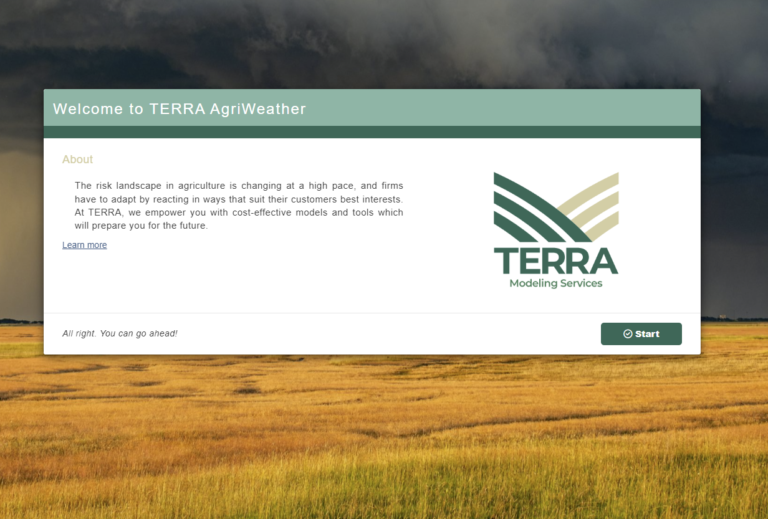
Say goodbye to cumbersome processes and hello to streamlined efficiency. Experience the power of simplicity with the #TERRAClimateExplorer – where valuable weather data is just a few clicks away.
Contact us at info@terra-ms.com f you want to find out more, and subscribe to our newsletter to ensure you don’t miss any of our posts and articles.
#TERRAModelingServices